The snow-covered cone of Cotopaxi is the closest I’ll come to snow in Ecuador. We hiked at around 4,500 meters (14,000 ft), and snow doesn’t normally come below the 5,000 metre mark on the southern slope. (Richard McGuire Photo)
Written: Latacunga, Ecuador
Yesterday afternoon I arrived back in the highlands after a few days on the Pacific Coast. Latacunga is a small city that has been destroyed three times by eruptions of the volcano Cotopaxi, and each time the residents have rebuilt it. The last eruption was over 100 years ago, and one of my guidebooks, written a few years ago, suggests it isn’t ready to erupt again for a few years yet.
The trip to the Pacific Coast had its ups and downs, but in hindsight, I probably should not have done it, and spent more time in jungle and highlands instead. There were many long intolerable hours spent cramped on slow buses that stopped everywhere, it was hot and muggy, the beaches were dirty, and added to that I got sick for good measure. Atahualpa punishing me for actions of the Spaniards 500 years ago no doubt.
I did get a chance to bounce around in waves that were high enough for good surfing, and also had a chance to experience the Pacific side of Ecuador. It seems generally poorer than many places on the central plateau and many houses perched on stilts sit above festering flood waters. There are vast banana plantations on the lowlands between the coast and the mountains.
Despite a bus ride that cramped my legs so much I could hardly walk when I got off, the scenery climbing the Andes from the coastal lowlands was spectacular. The mountains are green and rounded — not jagged like the Rockies. Cultivation and animal grazing is done as amazing elevations and on incredible slopes.
Today, against my better judgment, I went on a day hike to Cotopaxi with a guide and an Irish/Greek couple. I was feeling weak already from being ill and on antibiotics, and you shouldn’t do any tough climbing coming from the coast without acclimatizing to the altitude for a few days. I felt dizzy and often had to stop to gasp for oxygen, but fortunately didn’t experience any of the more serious symptoms of altitude sickness. It was worth it — even though the views weren’t like the crystal-clear sky travel posters, they were better than I expected, and the clouds often cleared enough to see much of Cotopaxi’s snowy cone. I had feared the mountain might be completely obscured by clouds.
The snow was probably about 500 metres higher up in elevation. We climbed at 4,500 metres (14,000 feet), but I didn’t need to get any closer to the snow. I’ll see more than enough in one week from now.
Tomorrow and Saturday I plan to check out a couple of Ecuador’s better known Indian markets. Unless anyone wants me to bring back a llama or some piglets, I don’t think I’ll find much tomorrow, but it should be colourful.
The snow-capped peak of Cotopaxi Volcano is covered in clouds as the sunlight breaks through. This valley became a flow of lava and mud when Cotopaxi last erupted at the end of the 19th century, destroying the nearby city of Latacunga. The plant in the foreground is a chuquiraga jussieui, which is used as a medicinal plant for the kidneys. (Richard McGuire Photo)
The barren landscape at the high elevation on the slopes of Cotopaxi had little vegetation — much less than Parque Cajas. What there was sometimes stood out dramatically. (Richard McGuire Photo)Vegetation on a barren slope of Cotopaxi. The orange flowers at right are apparently good for the kidneys. (Richard McGuire Photo)
Weekend bathers at Canoa on Ecuador’s Pacific Coast in waves that were better suited for surfing. It was funny to bathe in the Pacific in the Eastern Standard time zone — an illustration of how much further east the South American continent is. (Richard McGuire Photo)
Written: Bahía de Caráquez, Ecuador
One of the problems of not being able to keep this blog up to date while travelling in remote areas is that by the time I am able to write, there is so much to tell about. Here are a few highlights from recent days:
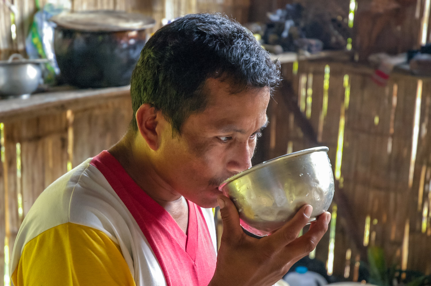
– I did a number of additional hikes with Victor, my Quichua Indian guide at Shangrila — some through primary forest, and some through secondary forest that had patches of agriculture. One one of these, he took me to two Quichua villages where his family lives. There, I took pictures of curious school children, and greeted them with a few Quichua words I learned, but have since forgotten, which amused them greatly. At Victor’s uncle and aunt’s place — a bamboo hut — I was offered the local beverage, chicha de yucca. This, I had read, was made by older women chewing the root of the yucca plant, and spitting the mixture of chewed up yucca and saliva into water, where it is allowed to ferment for a couple days. I knew about this process, but also knew it is offensive to turn down an offer of chicha de yucca. In the end, I sipped a bit of it, and then got Victor to surrepticiously finish off my bowl of the stuff. It really wasn’t bad tasting — just the thought of drinking someone else’s gob kind of made me squeemish.
– One day we did a trip down the Ansu River into the Napo River on two truck tire inner tubes lashed together. It was very relaxing floating on the tube in a bathing suit and watching the jungle go by with exotic birds flying around. The junction of the two rivers is a favourite spot for kayakers and there was a group of Americans kayaking as we floated by. Victor assured me there are no piranhas in these parts, although they do exist further down river. Apparently you can swim with them, and they don’t usually go into a feeding frenzy unless they taste blood.
– After Shangrila, I had planned to spend a night in Tena to get washed up and organized, as all my clothes were dirty from the jungle. But I was warned that a strike was planned the next day that would shut down all roads and transportation in Napo province for an indefinite number of days. I was advised to get out of town immediately, while the buses were still running. To make a long story short, I ended up taking buses all through the night, and having to walk four kilometres on a dark country road around midnight, unable to find a place to stay (hotels close their doors early in Ecuador, and no one answers if you knock). I ended up taking numerous buses right across the Andes and to the Pacific coast, an ordeal that involved 19 hours on slow buses. At several points roads were knocked out by landslides, and at one place there was a 20 km lineup of cars and buses at 3 a.m. until the landslide could be cleared enough that traffic could get through. Then there was a mad race of vehicles passing one another on blind curves on dangerous mountain roads as everyone tried to make up for lost time. At least there was a big picture of Jesus at the front of the bus.
– Ecuadorean buses are not much fun. Riding them right through the night is even less fun, as I can’t sleep. The drivers blare music so that the speakers rattle, or worse, play bad videos. Usually these are bad Hollywood action movies dubbed into Spanish. On one bus, they had the nerve to show one of the Arry PottER movies, until passengers began yelling “fuera!” (out with it!). It was quickly replaced with a more appropriate bad Chinese kung fu action movie dubbed into Spanish, which settled everyone down. Although the buses are infinitely more comfortable than Guatemalan chicken buses, they are much less comfortable than Mexican buses, which in many cases are better than Greyhounds. The buses stop everywhere, and average speed, when they aren’t racing down canyons, is only around 40 km/h.
– Although I generally like Ecuador, and find the people friendly, I have one other pet peeve aside from the buses and the general love of noise. Ecuador is a coffee producing country, but most Ecuadorean restaurants give you a cup of hot water or hot milk and a jar of Nescafe if you order coffee. Yech.
– On the plus side, there’s a fantastic variety of fruits that are made into wonderful juices. These are surpassed among the countries I’ve been to only by Colombia. Aside from the juices that are familiar to North Americans such as pineapple, blackberry, and papaya, there are others that most gringos haven’t heard of — naranjilla, guayabana, and numerous others.
If it’s nice tomorrow I plan to spend the day at the beach on the Pacific trying hard not to think about all the freezing rain, snow, and miserable weather at home. I’ll be back in that soon enough.
A dog in Bahía de Caráquez on Ecuador’s Pacific coast takes a nap, perhaps dreaming of a large chicken roast. (Richard McGuire Photo)
Though no rival for futbol, volleyball is quite popular in Ecuador. These people were playing by the beach at Bahía de Caráquez on Ecuador’s Pacific coast. (Richard McGuire Photo)People walk along the beach under cliffs at Canoa on Ecuador’s Pacific coast. (Richard McGuire Photo)Three boys run along the beach at Canoa on Ecuador’s Pacific coast. (Richard McGuire Photo)
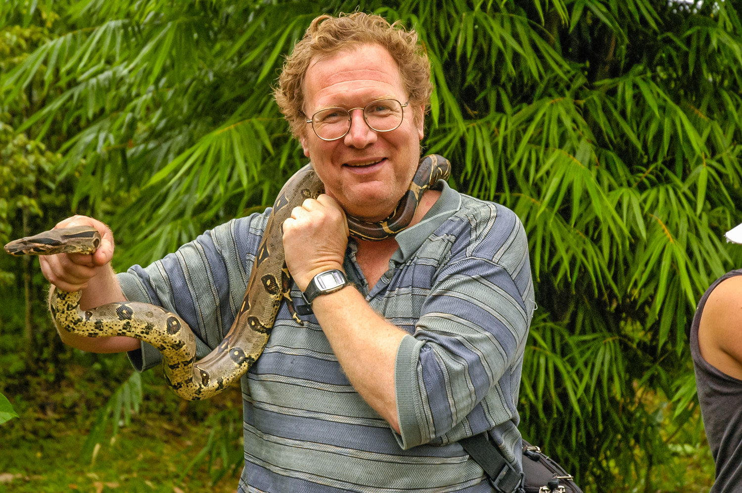
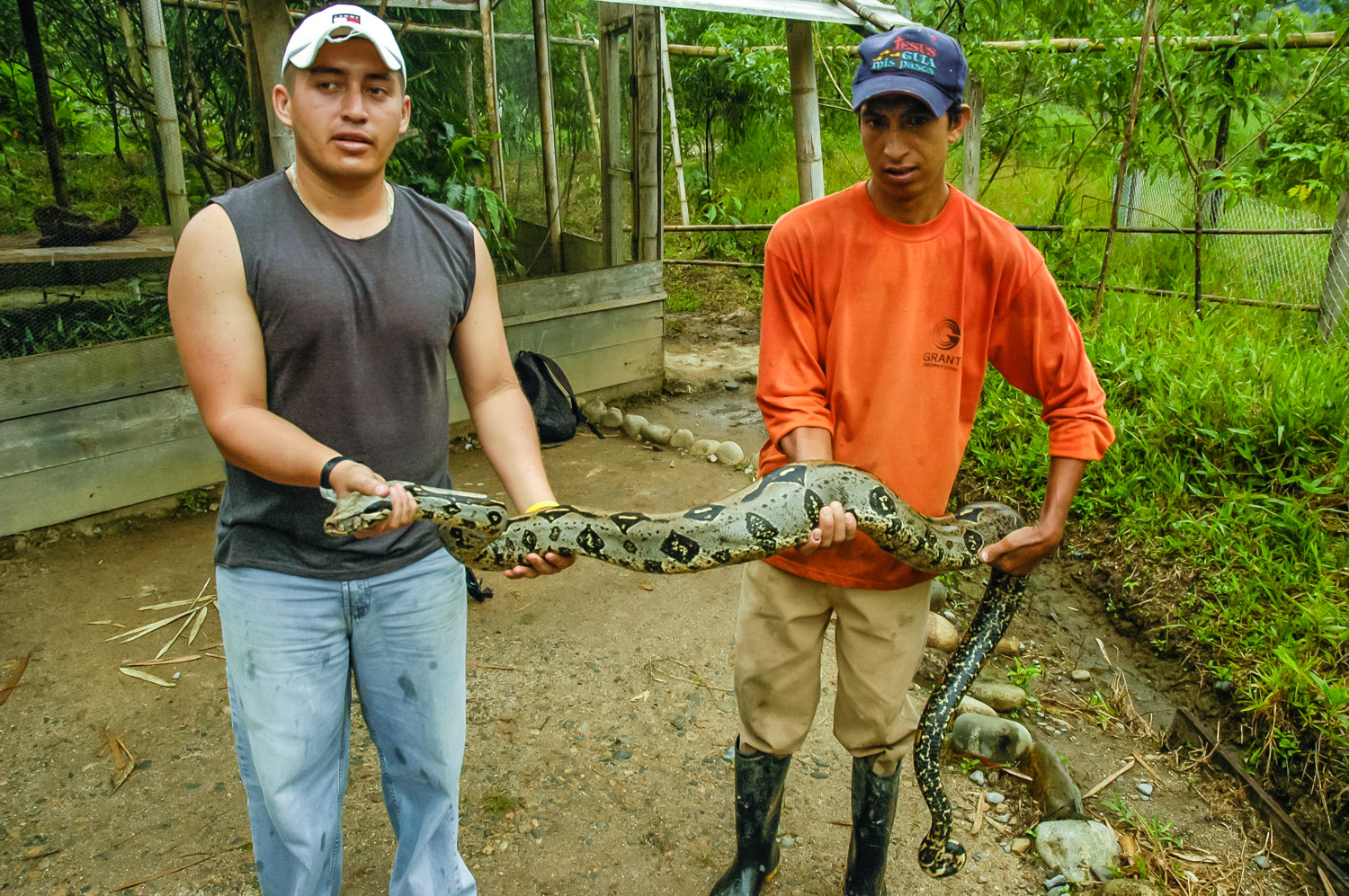
Here I am playing with a type of boa, known as a “Mata Caballos” or horse killer. Although these aren’t poisonous, they can bite, and can also squeeze. This one was in captivity.
Currently I’m in Bahía de Caráquez on Ecuador’s Pacific coast. The following was written by hand several days ago in the jungle when I didn’t have access to a computer:
Written February 14, 2006, Shangrila Lodge, near Tena, Ecuador
My Quichua Indian guide Victor pulled down a plant and cut off some leaves. These, he told me in Spanish, were an antidote in case of a bite by a poisonous snake. Apparently there are several poisonous snake species in the area, whose names he told me, but the only one I recognized was the coral snake.
Twenty minutes later, along a dense jungle trail, he pointed to the ground – a snake. It was small and dark and blended into the ground and I didn’t see it until he pointed it out. I slithered away at lightening speed. This one, Victor told me, was poisonous.
“Would you die if it bit you?” I asked.
“Yes, in about 25 minutes. But we’d be okay because of these leaves,” Victor told me, pointing to where he had put them in his string bag.
This is primary rain forest in an area where much of the land has been cleared, or has been overgrown again with secondary forest. I was alone with Victor, and I had to trust in his knowledge of this environment, which had been passed on to him by his father and grandfather. The jungle, I soon learned, for the Quichua people, was a huge supermarket and pharmacy, but it took an enormous knowledge of its many plants and animals to know which were beneficial and which were potentially harmful.
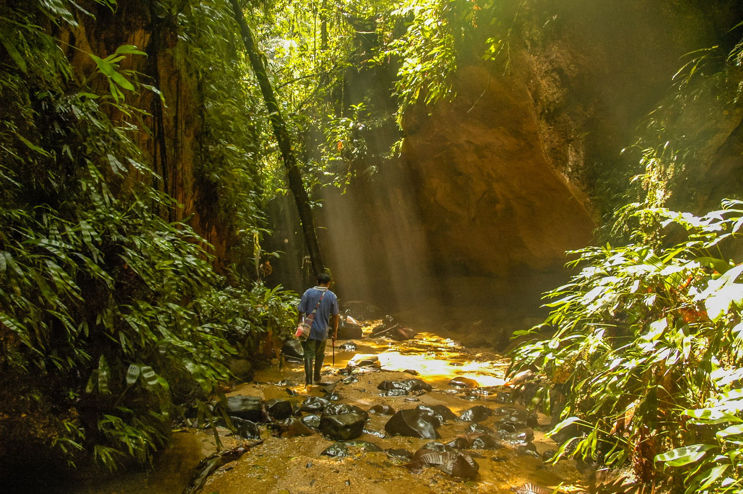
We wore rubber boots, which were prefect for walking in the rain forest. After descending a steep and muddy hill, and passing many squadrons of army ants and worker ants to the loud sound of chirping insects and birds, we arrived at a stream bed. Walking was easy in the stream which formed a natural pathway clear of most of the dense undergrowth. Victor warned me not to walk on the black rocks, which are very slippery, but instead on the brown ones that provided a lot of traction. I also had to beware of places where the stream would come over the tops of my boots, but for the most part it was shallow.
Victor pointed out other medicinal plants – one that is a natural anaesthetic against tooth aches, one for stomach problems, one for colicky children, and one with a distinctive smell that chases away bad spirits, and can get rid of headaches.
At one point he reached into a mossy tree and pulled out some small ants onto his fingers, which he invited me to taste as they crawled around. Lemon ants. I hesitated, but ate them anyway. Not being used to eating live ants though, one bit my chin causing a sharp sting that surprised me. We both laughed.
At last we reached a junction where one trail led up a hill and another up a narrow stream canyon. Victor looked me over, and decided I was capable of the stream canyon. This was an experience. The space between the walls of the canyon got narrower and narrower so that at times they were less than two feet apart, and I had to turn sideways to squeeze through. Though tough, this wasn’t too bad. But then the canyon came to a dead end. Here we would have to climb its walls. Victor told me to do exactly as he did, to put my feet forward against the wall in front, and sit into the wall behind, pushing behind me with my hands. Fortunately the gravelled rock wasn’t slippery, but it was somewhat difficult, and I was afraid of slipping and falling. Higher now, we edged up the canyon.
Victor flicked sand up into a dark area we were heading into, and out flew literally hundreds of bats. He kept flicking sand, and more emerged, now zipping around our heads. As we squeezed upwards, between the narrow canyon walls, I could feel the breeze from their wings on my face. These bats won’t bite, Victor reassured me. They are fruit-eating bats and not vampires. Still, this did seem quite different from my usual lifestyle in Ottawa to be slithering up a narrow canyon amidst hundreds of flapping bats.
Over the course of this and another walk in the afternoon, Victor showed me other jungle knowledge – how the fronds of large leaves can be woven to make a temporary shelter (why carry a tent?) or can make a camouflaged blind from which to hunt with blow darts or arrows.
The jungle was amazing, with so many broad-leafed plants, great ceibo trees, butterflies, hummingbirds, and incredible sized Conga ants. This was a walk unlike any other I’ve taken.
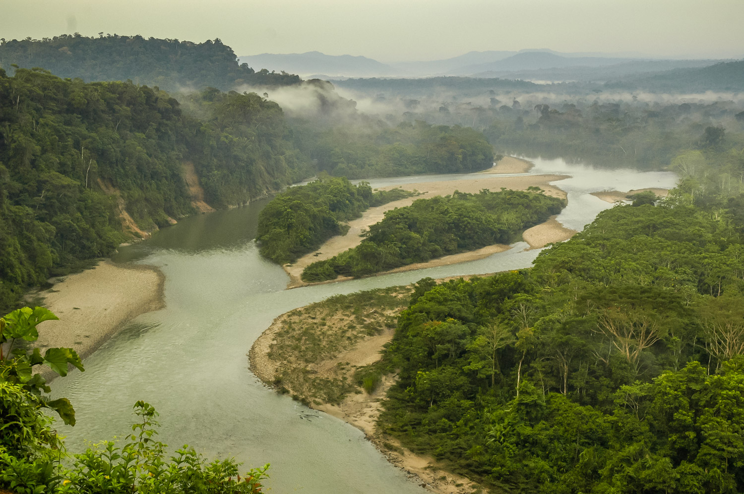
Shangrila itself is a cabin complex perched in an incredible location on the side of a cliff overlooking a big loop in the muddy brown Ansu River, a tributary of the Amazon, beyond which stretched miles of forest, and in the distant haze the foothills of the Andes.
The complex is built on many levels, and of wood. Until the last of three days, when a tour group arrived, I had the place pretty much to myself, along with the Ecuadorean staff. There’s a large open sheltered area at the top where numerous hammocks hang, and that’s where I’m writing this.
Last night when I arrived in Tena, there was an incredible thunder storm which flashing lightning. The thunder was the loudest I’d ever heard, practically shaking the buildings. Even my driver, who should be used to these weather events, commented how loud it was – like a war.
My Quichua guide Victor gave me a lesson in navigating through the rain forest near Tena, Ecuador. We wear rubber boots and wade up streams where there is less vegetation. There are still slippery rocks and mud to deal with. (Richard McGuire Photo)
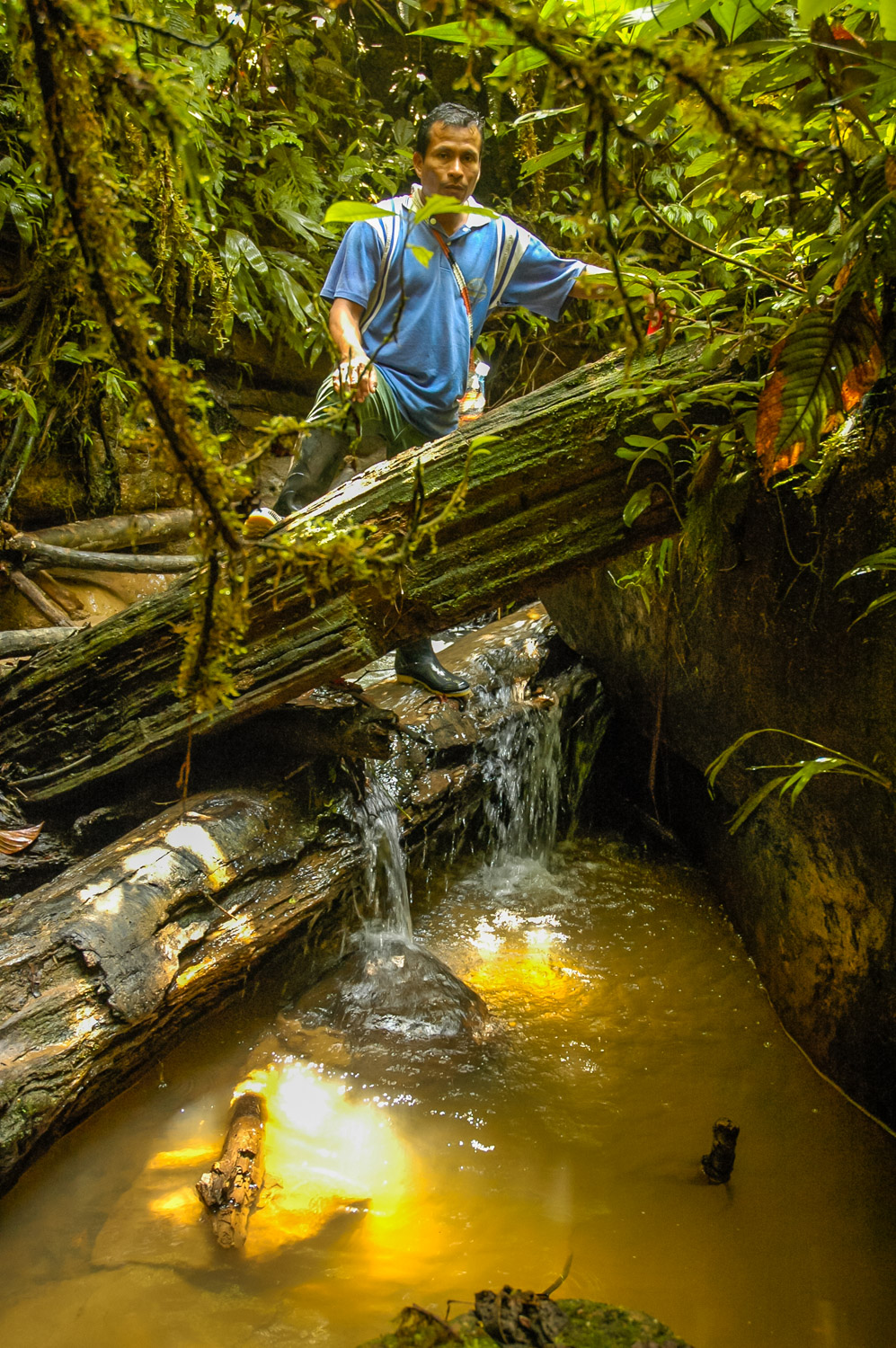
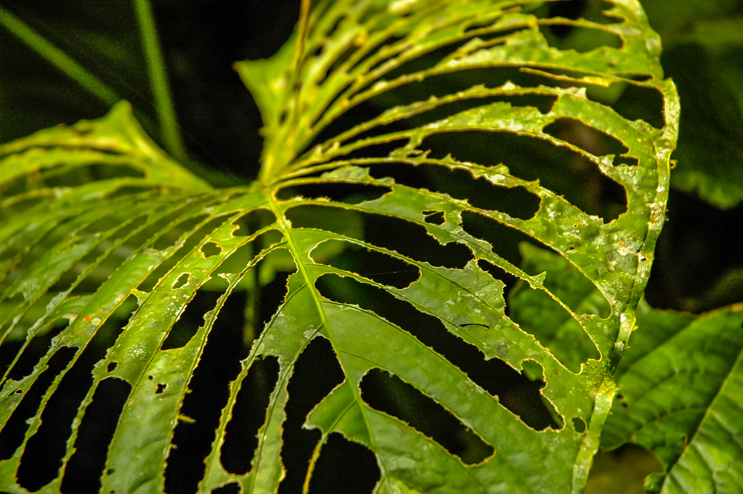
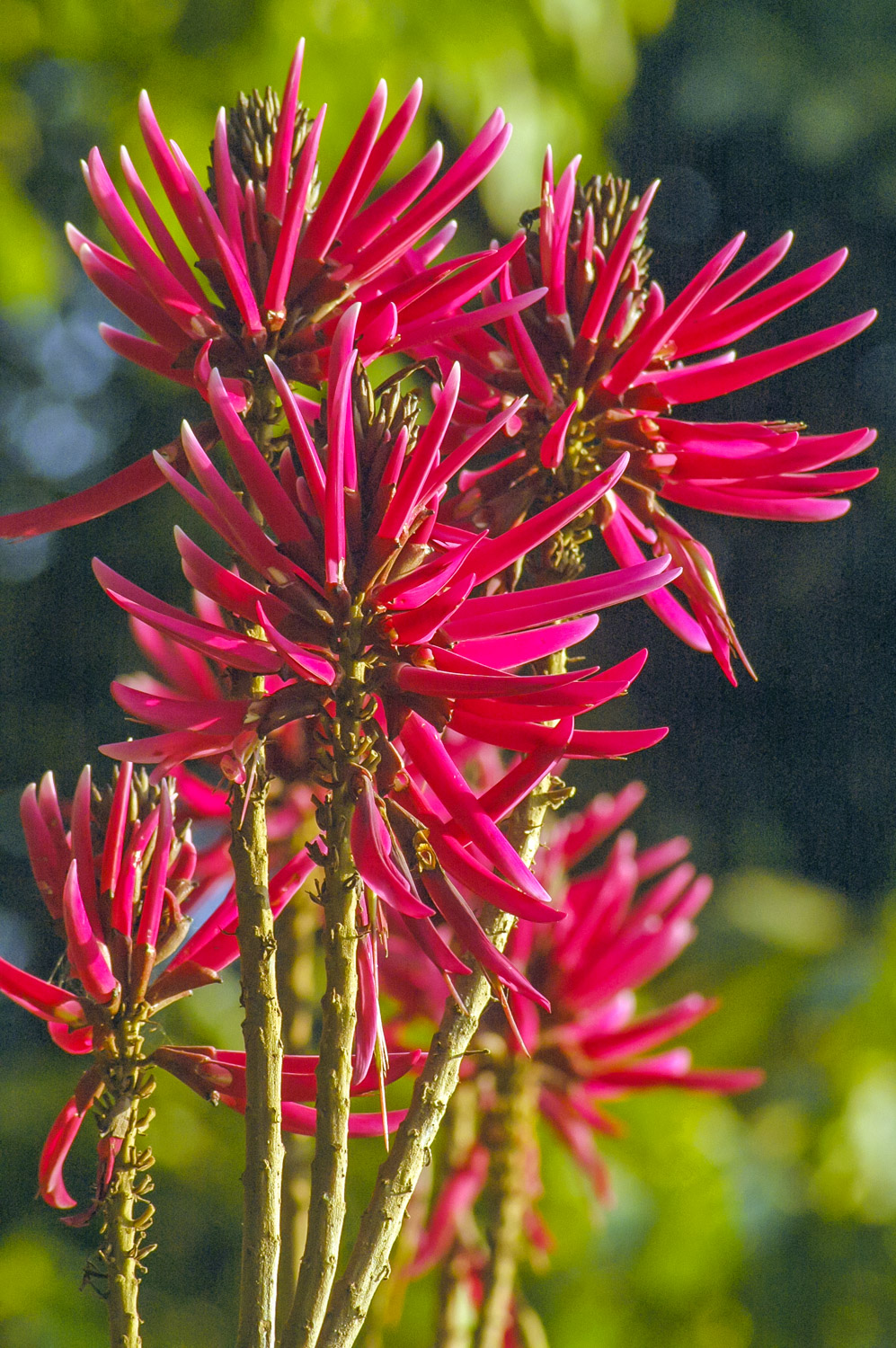
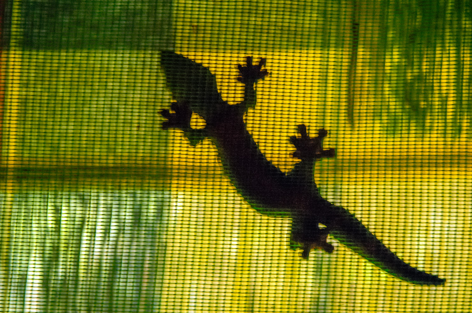
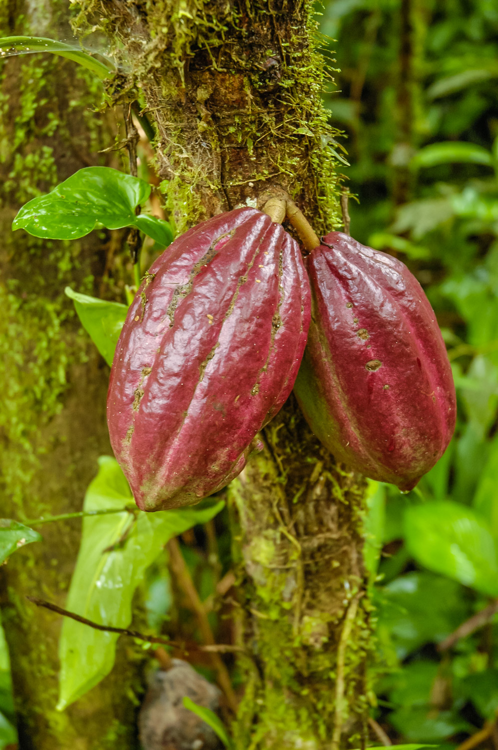
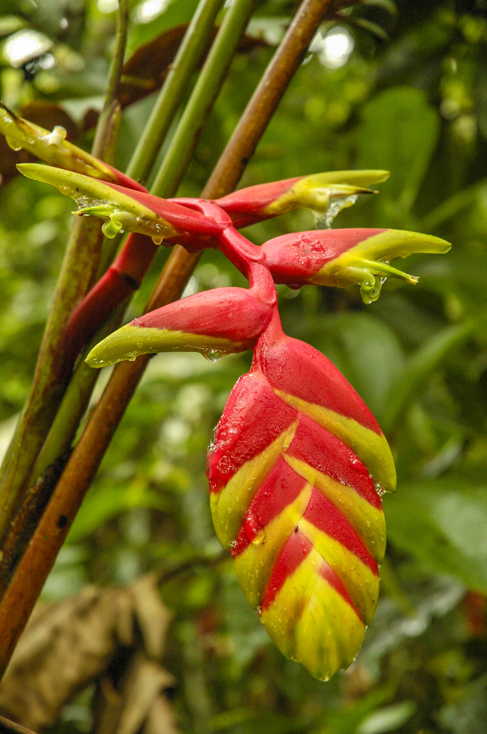
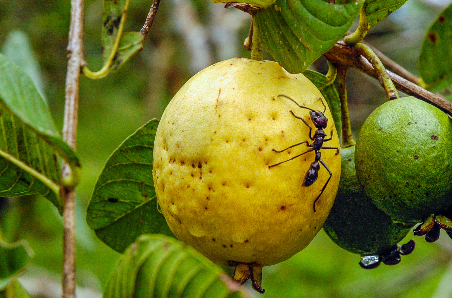
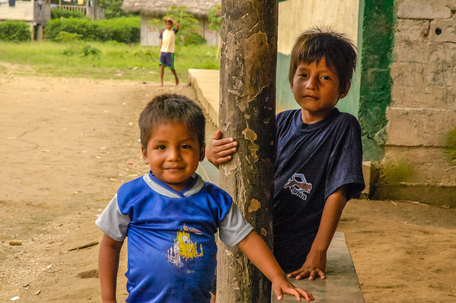
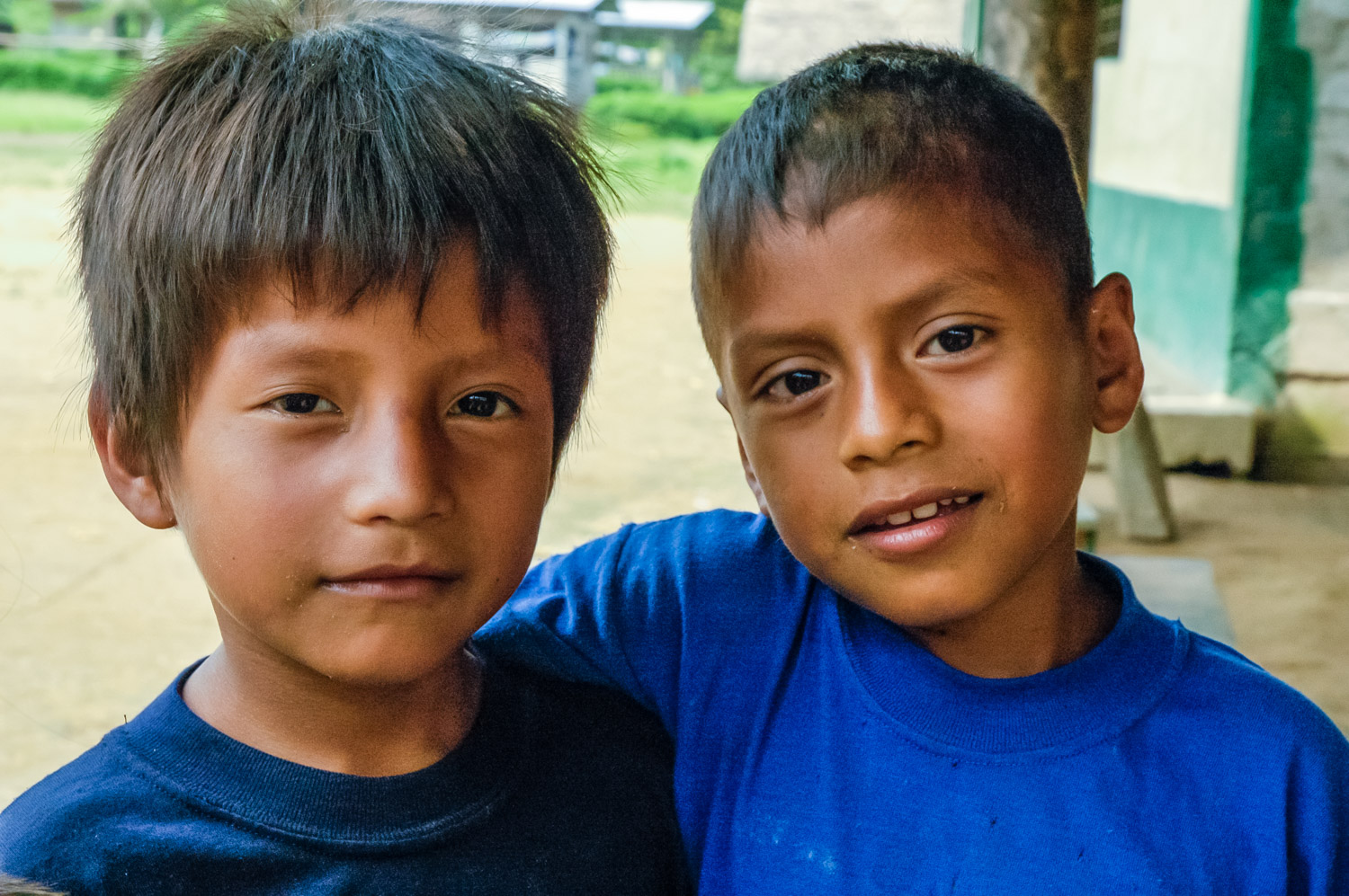
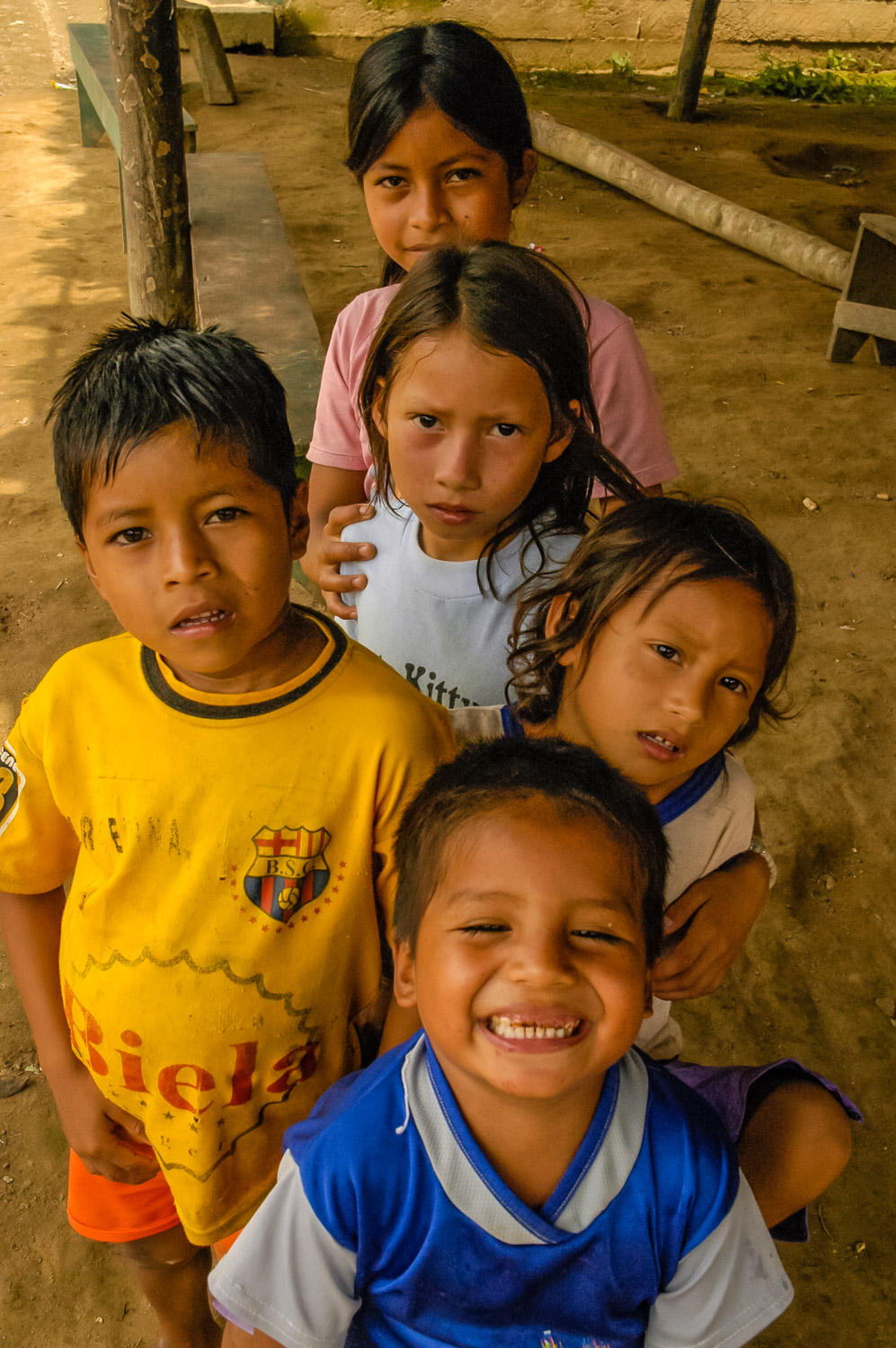
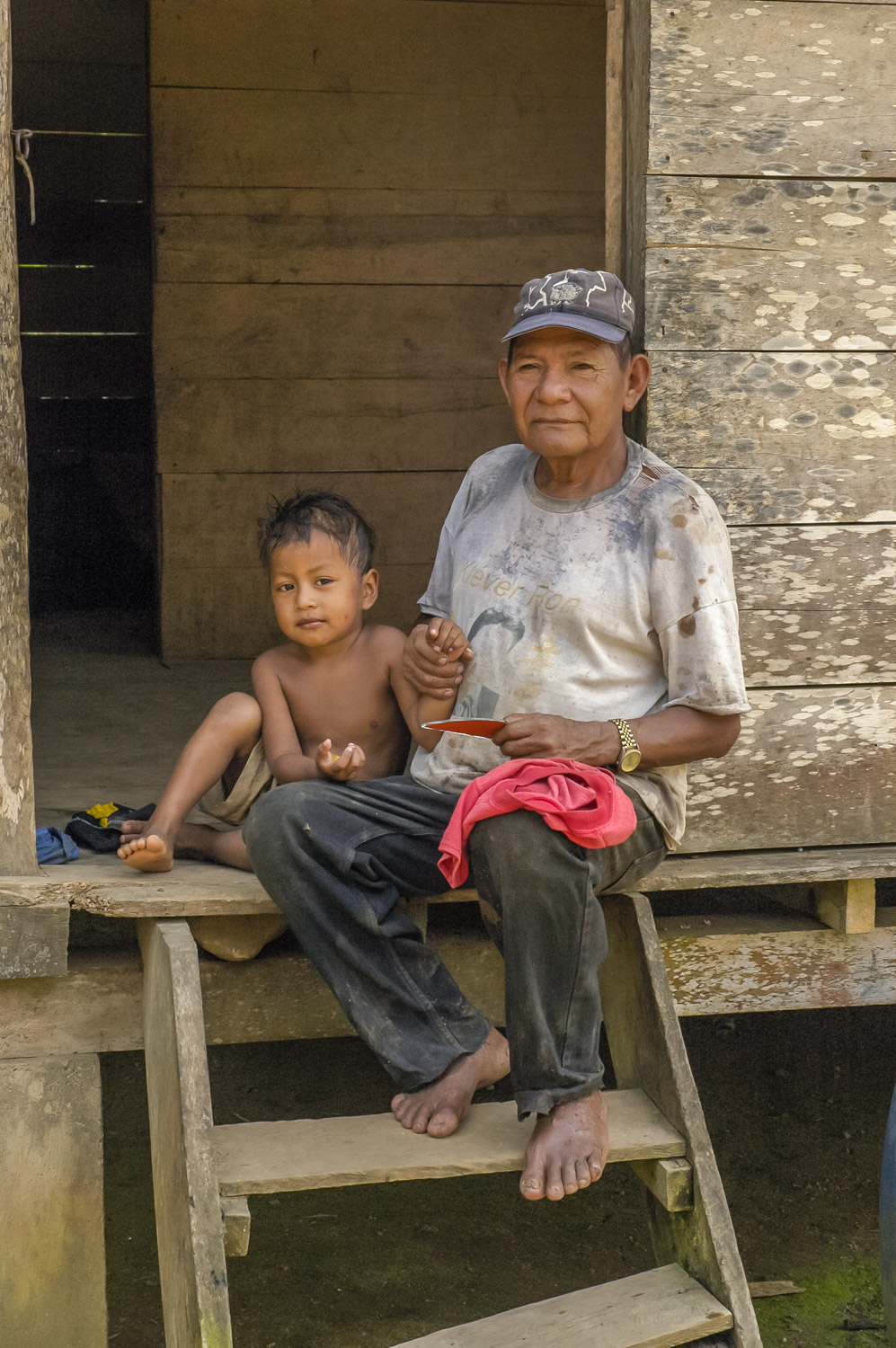
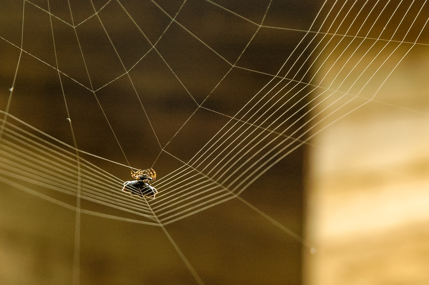
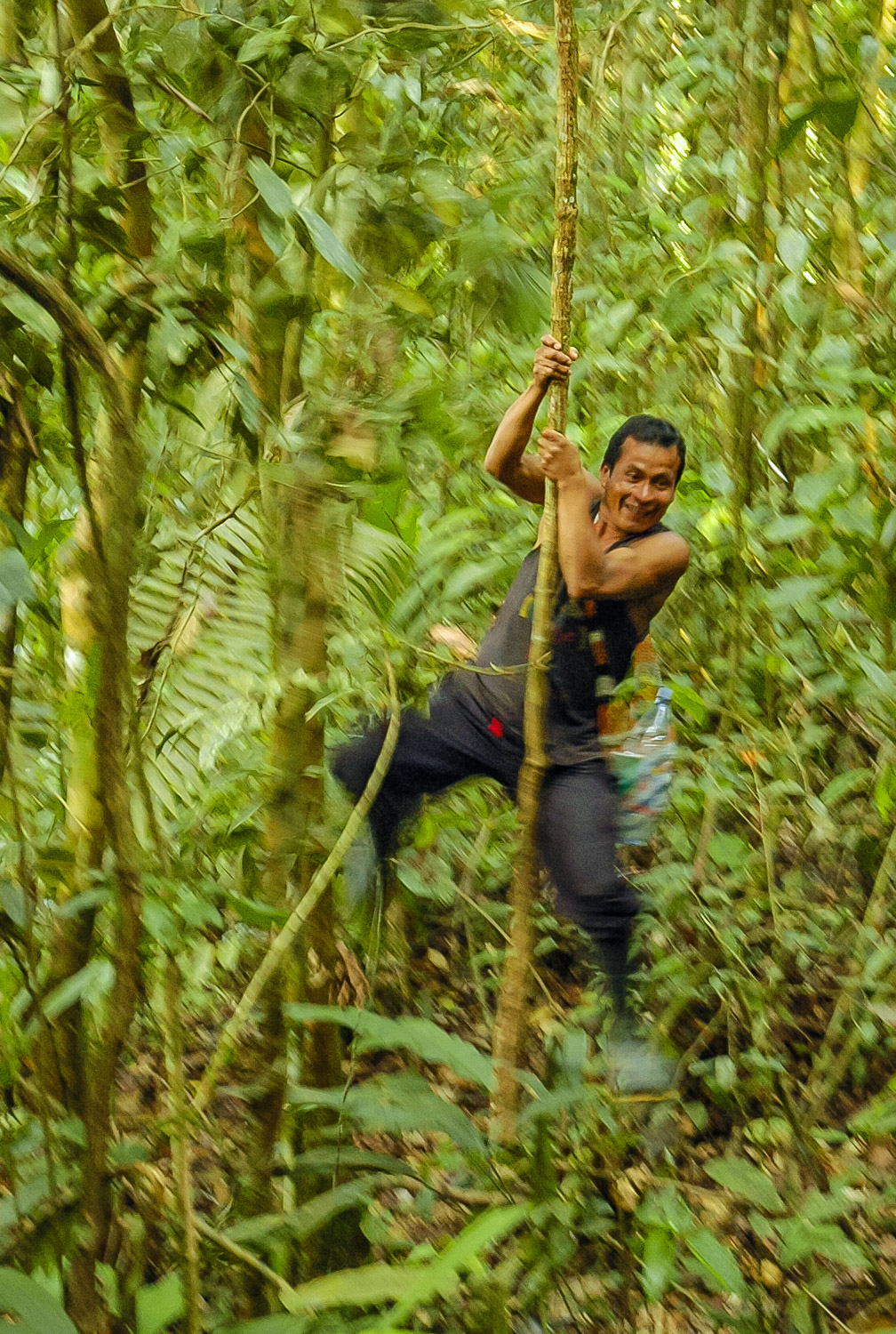
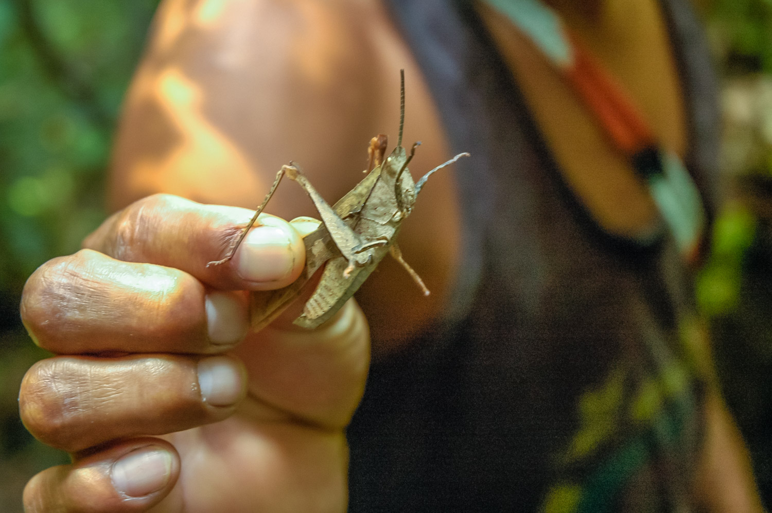
My Quichua guide Victor gave me a lesson in navigating through the rain forest near Tena, Ecuador. We wear rubber boots and wade up streams where there is less vegetation. Here we encounter an obstacle of fallen trees. (Richard McGuire Photo)Worker ants have feasted on this giant leaf in the tropical rainforest near Tena, Ecuador, leaving an interesting pattern. Lines of such ants and others can be seen moving along the jungle floor like advancing armies. (Richard McGuire Photo)This brilliant red flower grew on a small tree near my accommodation above the Rio Ansu near Tena, Ecuador. (Richard McGuire Photo)The sun lowers over the rainforest and the Anzu River at Shangri-La, a lodge near Tena on the edge of the rainforest. The Anzu is a tributary of the Amazon. (Richard McGuire Photo)A silhouetted lizard scampers up a nylon screen in my bathroom at a jungle lodge outside Tena, Ecuador. (Richard McGuire Photo)Two cacao pods grow near a village in the rainforest near Tena, Ecuador. Pods can contain 20 – 60 seeds, the beans that are processed into chocolate. (Richard McGuire Photo)These brilliantly colourful heliconia plants are found throughout the rainforest of Ecuador’s Oriente region. When they open up, they look like spectacular birds, and indeed a cousin of this one is known as the Bird of Paradise. (Richard McGuire Photo)A giant conga ant climbs on a guava outside a village in the rainforest near Tena, Ecuador. (Richard McGuire Photo)My Quichua guide Victor took me on a hike to two villages where his family lives. I greeted them with a few Quichua words Victor taught me, which amused them.(Richard McGuire Photo)My Quichua guide Victor took me on a hike to two villages where his family lives. I greeted them with a few Quichua words Victor taught me, which amused them.(Richard McGuire Photo)My Quichua guide Victor took me on a hike to two villages where his family lives. I greeted them with a few Quichua words Victor taught me, which amused them.(Richard McGuire Photo)My Quichua guide Victor took me to the bamboo home of his aunt and uncle. We were served chicha de yuca — a fermented drink made from the yuca (cassava) root being chewed and spat out by older women. I took a few sips before Victor offered to finish mine for me while the others weren’t looking. I accepted his offer. (Richard McGuire Photo)These two were in the village of my guide Victor’s aunt and uncle in the rainforest near Tena, Ecuador. (Richard McGuire Photo)In just two days the level of the Rio Ansu dropped, exposing more sandbars. This is the view from Shangri-la Lodge outside Tena, Ecuador. (Richard McGuire Photo)A spider weaves a work of art in the lodge where I was staying in the rainforest outside Tena, Ecuador. (Richard McGuire Photo)My Quichua guide Victor does his best Tarzan imitation as he swings through the jungle on a hanging vine. (Richard McGuire Photo)Victor, my Quichua guide, shows an insect he’s picked up on the forest floor near Tena, Ecuador. (Richard McGuire Photo)These men brought out a large boa at an animal facility near Tena, Ecuador. This is bigger than the one I got to handle. (Richard McGuire Photo)
A small monkey darts between trees in Tena, Ecuador in Amazonia. (Richard McGuire Photo)
Written: Tena, Ecuador
I’m now in steamy hot Tena, a town of about 20,000 people on the edge of the jungle. Tomorrow I head off for several days in the primary rainforest, staying in a jungle cabin not too far from here.
I left Baños this morning taking a bus along the same route towards Puyo that I took by bicycle yesterday. At the first tunnel, however, traffic had come to a stop. Word was that a landslide had closed the road, and traffic wouldn’t move until 3 p.m. It was now only 10 a.m. We were far enough out of Baños that going back wasn’t too practical an option. Faced with the likelihood of a wait of five hours or more, I decided to investigate walking. I asked a cop if pedestrians could pass. He indicated they could, so I grabbed my pack and began hiking through the tunnel. What I didn’t know was that the actual landslide was still about 5 km away. I crossed it around noon. As I headed to the next village in the hopes of getting transportation to Puyo, traffic began passing me, and I flagged down my original bus. Evidently the wait had only been a couple hours instead of five.
The driver tried to make up for lost time, barreling down the canyon, passing on blind curves with deep precipices to the side. I felt secure though — he had a couple plastic Virgin Marys on his dashboard, and they flashed in red and green lights whenever he hit the brakes. You need faith to take buses in Latin America.
Later that afternoon, I arrived in Tena. It was very hot and I was sweating and thirsty. After a few cooling drinks of agua mineral, I set off to a nice little zoological park on an island in the river. It was a jungle setting with lots of lush tropical trees and plants. The handful of animals had lots of room, and monkeys ran around freely, jumping between trees. I tried to photograph a few little ones who jumped faster than I could focus the camera.
Tomorrow I head off early in the morning for three days, and will be without Internet.
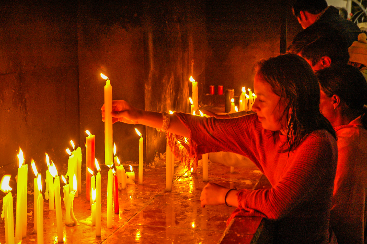
A girl melts the wax at the bottom of a candle so she can stand it up at Basilica de Nuestra Señora de Agua Santa (Our Lady of Holy Water) in Baños. The church is dedicated to the Virgin of Holy Water, who is said to have performed numerous miracles. (Richard McGuire Photo)
Written: Baños, Ecuador
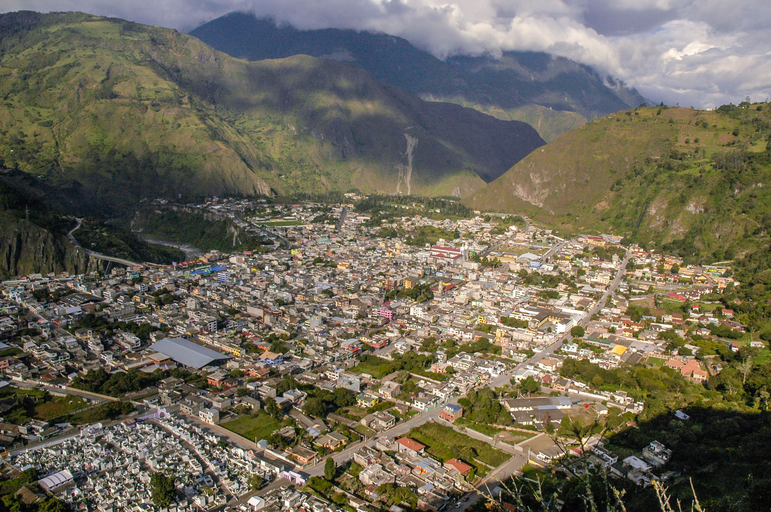
I’ve spent the past couple nights in Baños, a town that attracts both Ecuadorian and foreign tourists. Baños, whose name means “baths”, lies just below the active volcano Tungurahua, which at various times over the centuries has erupted and threatened the local inhabitants. Only a few years back, the volcano blew its top, forcing the evacuation of the community.
The volcanic activity has produced hot springs, which provide hot baths for locals and visitors.
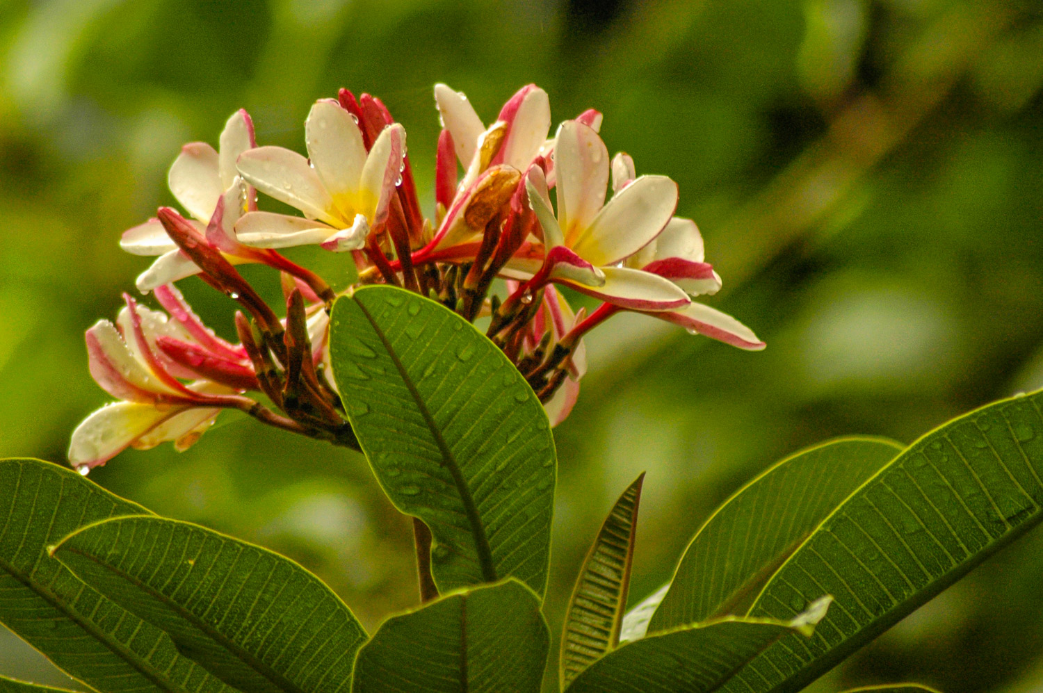
Baños lies at a comfortable 1800 metres (5,000 feet) which gives it a pleasant climate, rich with flowering trees and other plants. Currently though, it’s the rainy season, which has meant the town has been shrouded in clouds, and there are periodic rainfalls.
It’s also a centre of Catholic pilgrimage, as people come to visit the Basilica of Our Lady of the Holy Waters. There, the virgin, has been responsible for forestalling many disasters, including volcanic eruptions.
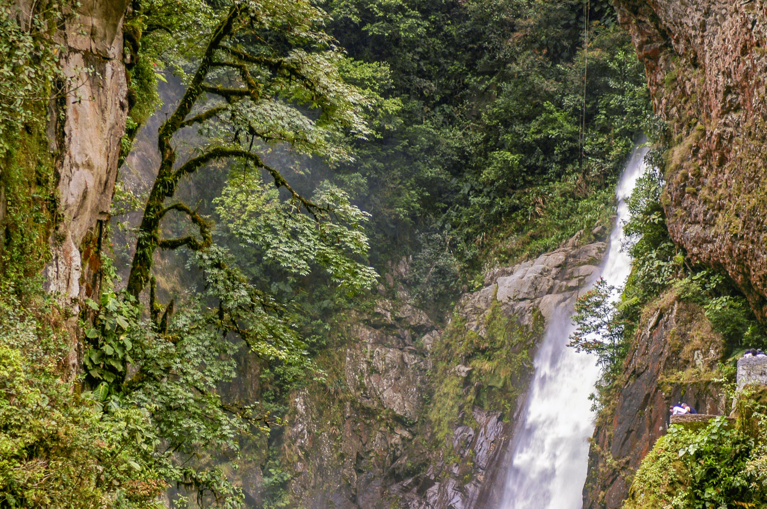
Today was one of the nicer days in a while, and I took advantage of it by renting a mountain bike and descending the canyon in the direction of the jungle village of Puyo. It’s downhill most of the way, so there were only a few times when I had to pedal uphill. Most of the time I could glide. Numerous waterfalls marked the route, including the most spectacular Pailon del Diablo (Devil’s Cauldron), which involved a hike down from the main road through increasingly jungle-like vegetation.
Tomorrow I head to Tena in the jungle.
The city of Baños, Ecuador, spreads through a valley below Tungurahua Volcano. (Richard McGuire Photo)
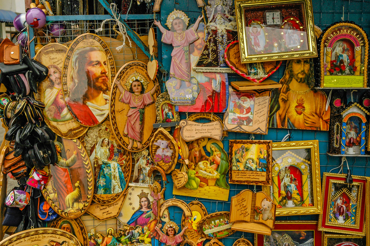
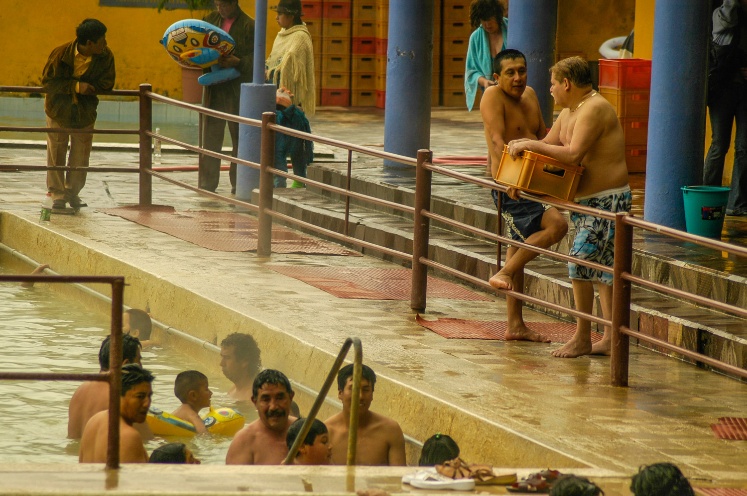
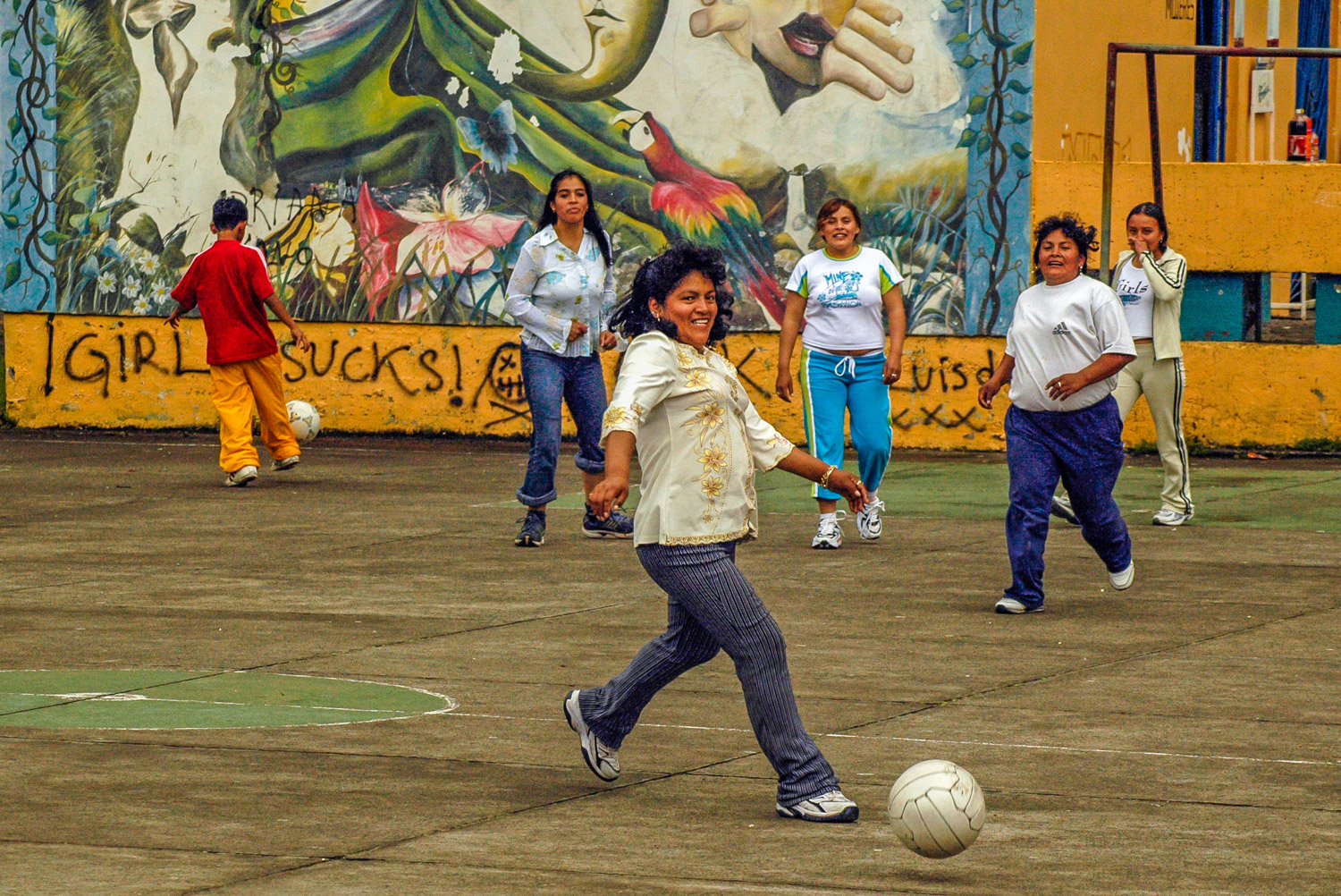
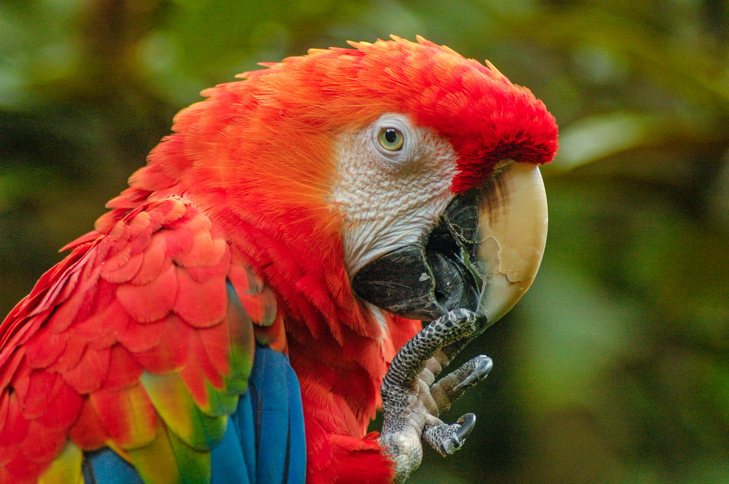
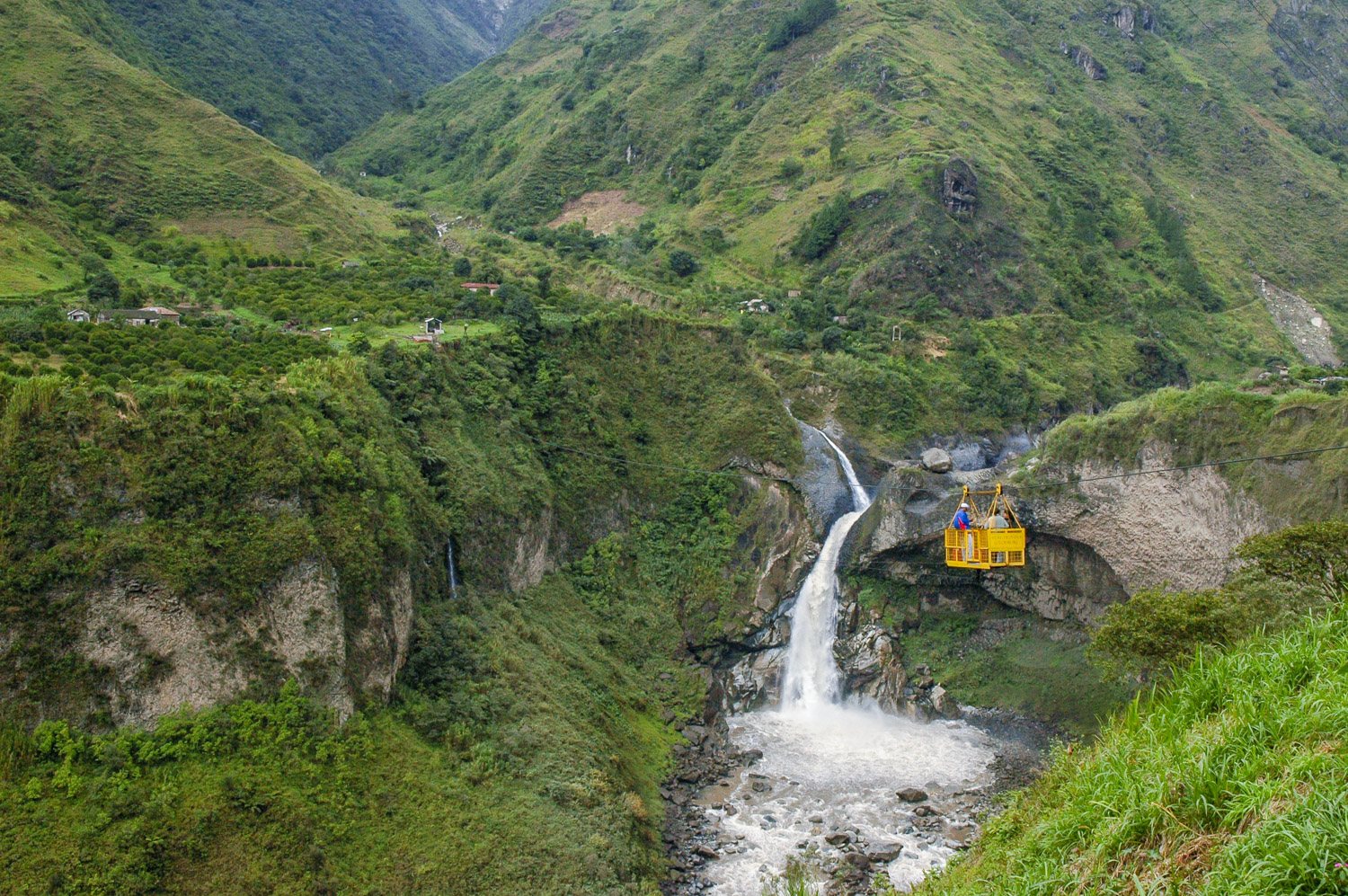
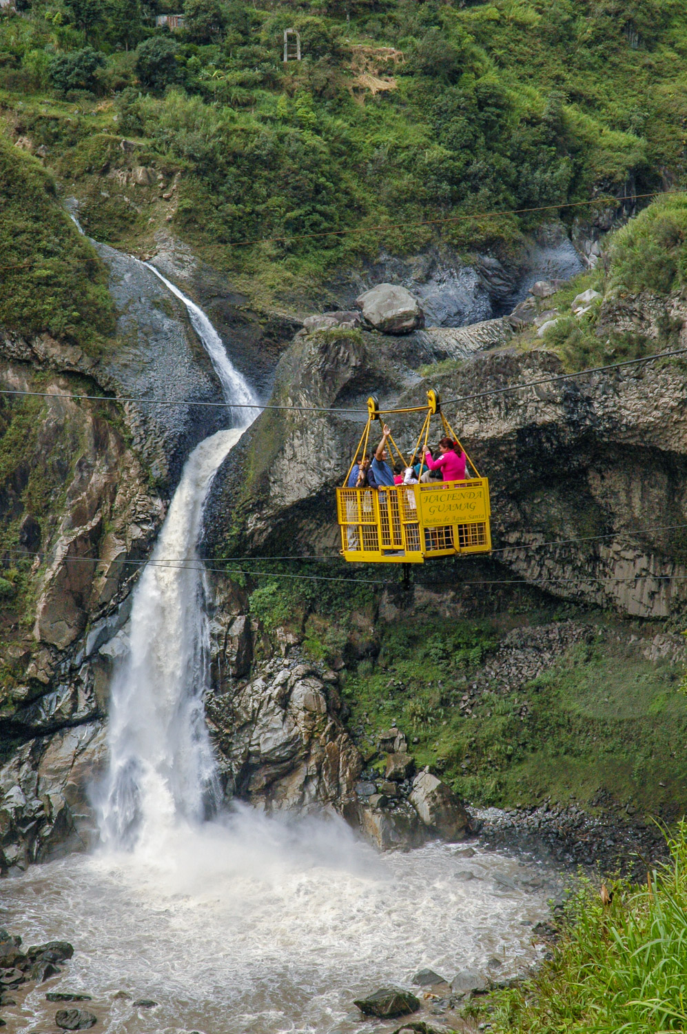
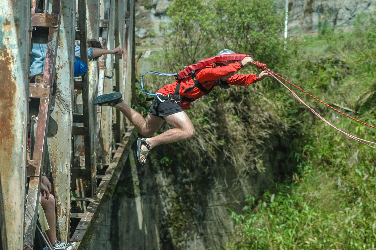
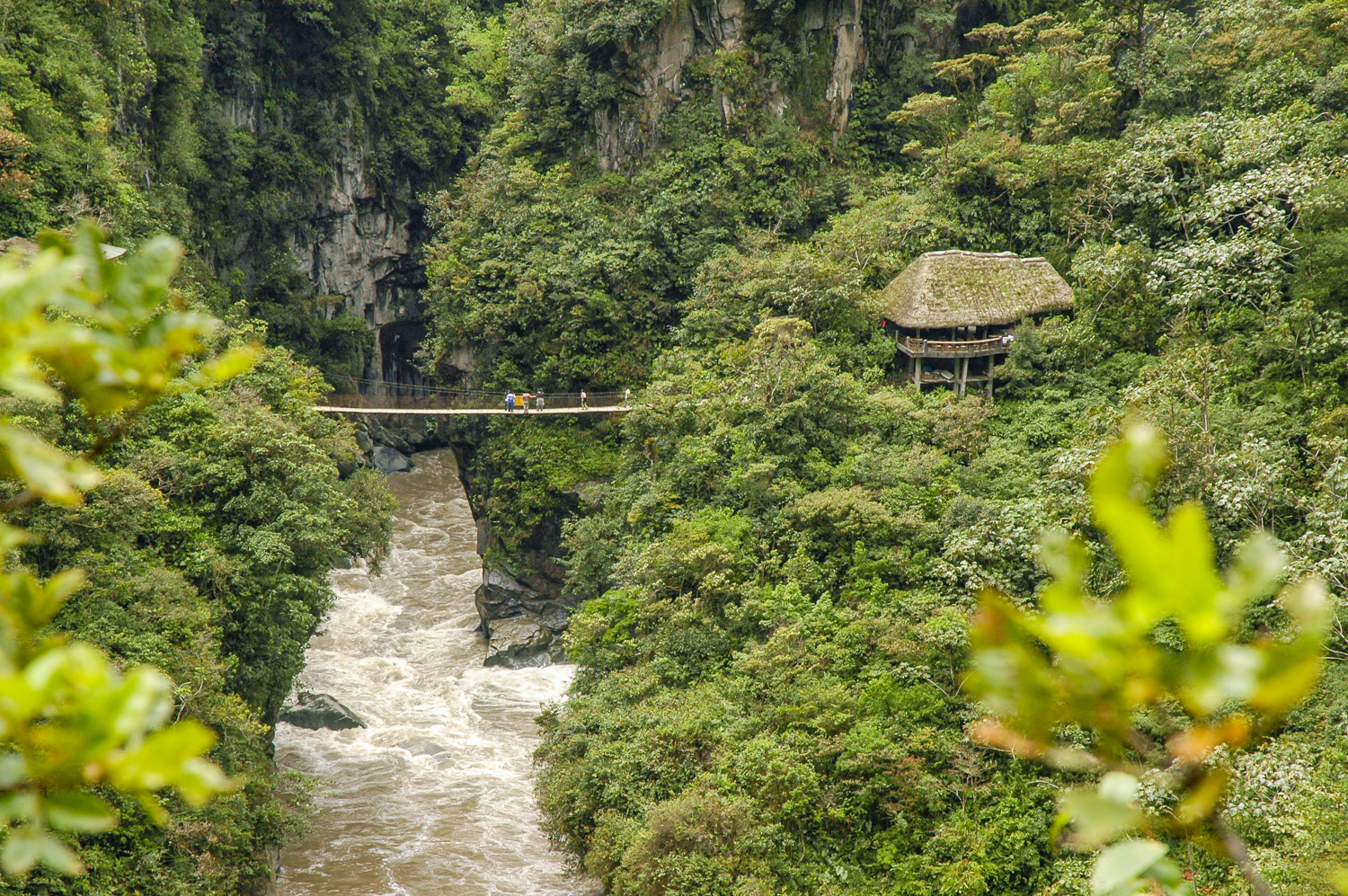
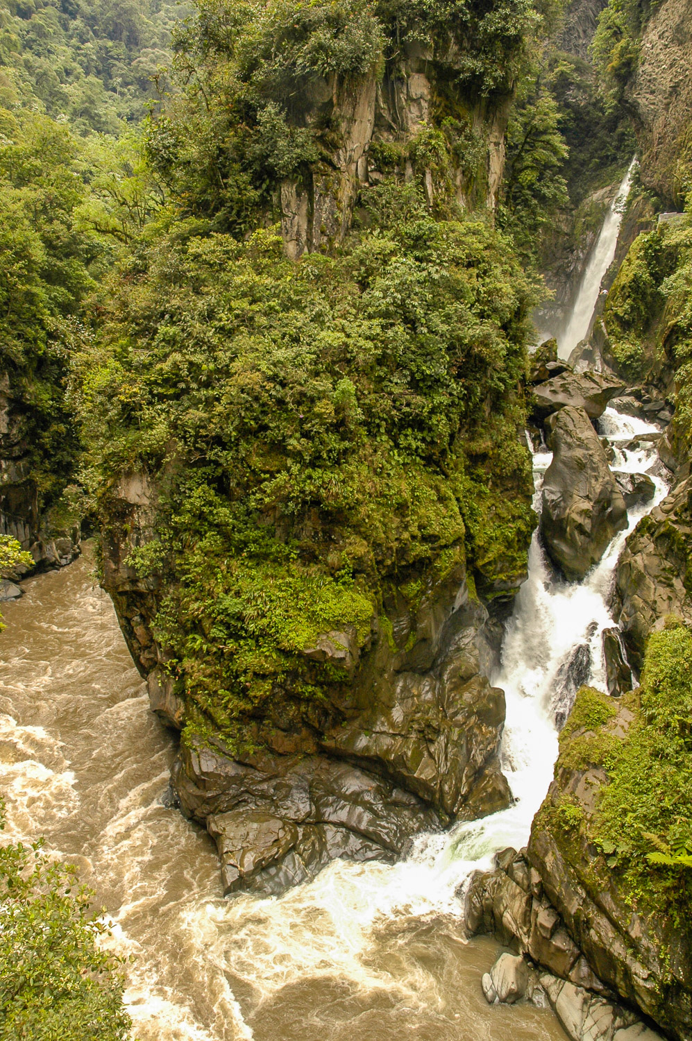
A blossoming tree after a rainfall in Baños. (Richard McGuire Photo)Religious paraphernalia was on sale at a stall outside the basilica in Baños, Ecuador. Plastic handguns were available at the stall next door. (Richard McGuire Photo)People bathe in La Virgen thermal baths in Baños. (Richard McGuire Photo)Women play futbol (soccer) in Baños, Ecuador. They were amused when I took some photos of their game. (Richard McGuire Photo)This brilliantly colourful scarlet macaw lived in the gardens at my hotel in Baños. These exotic birds are among the many from the rainforests of Ecuador’s Oriente, the headwaters of the Amazon River. (Richard McGuire Photo)A cable car takes passengers across the gorge next to Agoyan Waterfall down the Rio Pastaza from Baños, Ecuador. (Richard McGuire Photo)A cable car takes passengers across the gorge next to Agoyan Waterfall down the Rio Pastaza from Baños, Ecuador. (Richard McGuire Photo)A tourist jumps off a bridge to bungee dive over a river near Baños, Ecuador. The operators brought their ropes and harnesses to the bridge to do business. (Richard McGuire Photo)The raging waters of the Río Pastaza tumble down the mountains at Pailón del Diablo (Devil’s Cauldron) waterfalls on the descent from Baños in the mountains to Puyo in the rainforest. These falls tumble into a raging cauldron before continuing down among huge boulders. (Richard McGuire Photo)The raging waters of the Río Pastaza tumble down the mountains at Pailón del Diablo (Devil’s Cauldron) waterfalls on the descent from Baños in the mountains to Puyo in the rainforest. These falls tumble into a raging cauldron before continuing down among huge boulders. (Richard McGuire Photo)The raging waters of the Río Pastaza tumble down the mountains at Pailón del Diablo (Devil’s Cauldron) waterfalls on the descent from Baños in the mountains to Puyo in the rainforest. In the rocks below, you can make out images of the devil’s face. These falls tumble into a raging cauldron before continuing down among huge boulders. Note the two figures near the lower right for an idea of scale. (Richard McGuire Photo)
At a high elevation in the Andes, only scrubby vegetation grows. This is called “páramo” and it superficially reminds one of northern tundra. Cajas National Park, near Cuenca, offers many páramo landscapes with numerous lakes. The elevation here is around 4,200 metres (roughly 13,000 feet). (Richard McGuire Photo)
Written: Cuenca, Ecuador
Cajas National Park straddles the continental divide in the Andes just west of Cuenca. It is known for its highland paramo landscape — largely open grassland and scrub vegetation, not entirely unlike our northern tundra, and also for its many lakes, which provide 60% of Cuenca’s drinking water.
Although you can take a local bus up there and hike on your own, I opted to go on a hiking tour with a local guide, partly for easier access to areas I couldn’t get to on my own, and partly for safety — hiking at that elevation can be dangerous. The starting point was at around 4,200 metres or roughly 13,000 feet. At that elevation, altitude sickness is a strong possibility. One young woman in our group did experience symptoms, as she had recently come from sea level on the coast. Although I found Quito rough when I first arrived, I’ve now had over a week to acclimatize and all I experienced was shortness of breath on the steep ascents. In fact I was hyperventilating at times to get enough oxygen.
The open space is deceiving — there is a wealth of plant life. Most unusual were occasional forests of twisty trees — looking very enchanted and fairy tale like. These are apparently the highest forests in the world, and they cling to rocky sheltered ridges.
At one point we saw a mother alpaca and young son (see photos) and there were some interesting birds, but as for other animals, the only evidence of foxes etc. were droppings. Some in our group saw a condor in the distance, but I missed it.
The finale was dining on Canadian rainbow trout, which has been brought in to stock many of the lakes. Kind of ironic to travel to Ecuador to eat Canadian trout.
The Inca ruins at Ingapirca are closed due to a dispute between the indigenous peoples and the government, so I’m off tomorrow to Baños, another old hippie favourite known for its hot springs, active volcano, and excellent walks.
A group of hikers walks by small lakes in the páramo landscape of Cajas National Park near Cuenca, Ecuador. (Richard McGuire Photo)A group of hikers walks by small lakes in the páramo landscape of Cajas National Park near Cuenca, Ecuador. (Richard McGuire Photo)Often mistaken for an alpaca, the llama is a related animal found in the Andean highlands, both wild and domesticated. (Richard McGuire Photo)Its young baby by its side, this mother llama watches protectively. These llamas wander freely throughout Cajas National Park in the mountains near Cuenca in the south of Ecuador. (Richard McGuire Photo)Often mistaken for an alpaca, the llama is a related animal found in the Andean highlands, both wild and domesticated. (Richard McGuire Photo)Its young baby by its side, this mother llama watches protectively. These llamas wander freely throughout Cajas National Park in the mountains near Cuenca in the south of Ecuador. (Richard McGuire Photo)This puya hamata plant seems to explode when viewed from above. This spiny cousin of the pineapple can be found frequently in the high-elevation páramo of Cajas National Park in Ecuador’s south. (Richard McGuire Photo)
A man reads a paper and relaxes while his shoes are shined in the arch of a colonial building on the main square in Cuenca. Cuenca, in Ecuador’s south, has many buildings that preserve the colonial Spanish architecture. (Richard McGuire Photo)A woman sells colourful flowers at her stall in Cuenca, Ecuador. Because of its climate, Ecuador exports flowers to North America. (Richard McGuire Photo)A young cat looks longingly (or curiously) at buckets of fruit for sale on the street in Cuenca, Ecuador. (Richard McGuire Photo)
It was a long, but beautiful walk up a path through a valley to my cabin near Vilcabama in the south of Ecuador. (Richard McGuire Photo)
Written: Cuenca, Ecuador
I arrived tonight in Cuenca, Ecuador’s third largest city, and a relatively pleasant colonial town. I plan to use it as my base for the next few days for trips to a national park in the highlands, and to some Inca ruins.
Vilcabamba was a very nice break, and I spent three nights in the little cabin perched on the side of the mountain. I opened my screenless windows wide each morning to look out across the valley at the lush mountains across from me and watch the mist creep up the valley, with only the sound of the raging river and birds.
I took a hike one day up a steep ridge and along the side of a steep mountain, passing through pastures with grazing cattle, horses, and donkeys, and crossing little streams covered in dense tropical vegetation. The rainier season came early to the Vilcabamba area, and periodically downpours force me to take shelter — once in an empty adobe farmhouse. Rain also made the trails pretty muddy.
I had hoped to organize a horse trip into the highlands, but the weather and lack of other visitors to the cabins forced me to scrap that plan. Still, it was a good relaxing time. I spent my last day relaxing in a hammock and reading.
One of the interesting things about travelling is the people you meet. On my last night in Vilcabamba, a couple arrived, and coincidentally they were from Toronto (the only other couple I met there the first night was from the Netherlands). The Toronto couple worked in the film industry, and had a 35-foot sailboat that they were sailing around the world in, returning home periodically to work — planning their trips home to escape the hurricane season in the south and winter in the north. They generate electricity on their boat with solar panels and wind. Why would they need electricity? Although they use a laptop computer, the main reason is to power a fridge and freezer so they can have cold beer and can freeze the many fish they catch. They described catching a six-foot tuna of the kind used to make sushi, but decided it was more than they could handle, so let it go. They figure it would be worth a lot of money in Japan.
The couple who run the cabins, Charlie and Sarah, have two kids who speak English and Spanish interchangeably. They served meals to guests around a big table by a fire in an open shelter. Charlie runs excursions to a refuge up in the mountains on their own private nature preserve, and he considers himself one of the ecotourism pioneers of Vilcabamba. I told them I would highly recommend their cabins to those wanting to get away to nature.
An old adobe house was by the pathway between the valley where I was staying and the town of Vilcabamba, Ecuador. (Richard McGuire Photo)A man walks along the country road leading into Vilcabamba, Ecuador. (Richard McGuire Photo)Storm clouds darken the sky behind the silhouette of a twisty tree in the lush green hills of Vilcabamba in the south of Ecuador. Vilcabamba has a reputation for being a place where people live exceptionally long lives. Although investigation has cast doubt on some of these claims, there’s no doubt that its healthy and moderate climate is invigorating. (Richard McGuire Photo)A group of people walks along the road into Vilcabamba, Ecuador as a storm approaches. (Richard McGuire Photo)Raindrops cling to coffee beans near Vilcabamba, Ecuador. The beans turn red when they are ripe. (Richard McGuire Photo)A stream flows through lush forest on a mountainside near Vilcabamba, Ecuador. (Richard McGuire Photo)A partially rotted wooden gate stands beside a trail in the mountains near Vilcabamba, Ecuador. The damp climate results in lush green vegetation. (Richard McGuire Photo)
Ecuador is not a large country, but within its small boundaries it offers a mix of Andean highlands, tropical Pacific coast and Amazon rainforest.
At the beginning of February 2006, after managing a grueling election campaign, I flew to Quito, the capital, to begin a three-week exploration of this fascinating country. I hoped to get an overview of Ecuador’s different regions with one important exception — I didn’t have the time or money to visit the Galápagos Islands in the Pacific Ocean.
Ecuador is one of the most Indigenous of the Latin American countries with many people descended from the Incas and their neighbours and speaking Quichua. Most however, except in the most isolated areas, also speak Spanish.
My journey got off to a bad start when my early morning flight from Ottawa to Newark was cancelled. I scrambled to get re-routed through Toronto. It was a nightmare with very little time to make my connection and with having to transfer between two different terminals then wait in a security line to recheck my bags as the clock ticked down.
I despise airports and by the time I reached Quito late that night I was frazzled and exhausted.
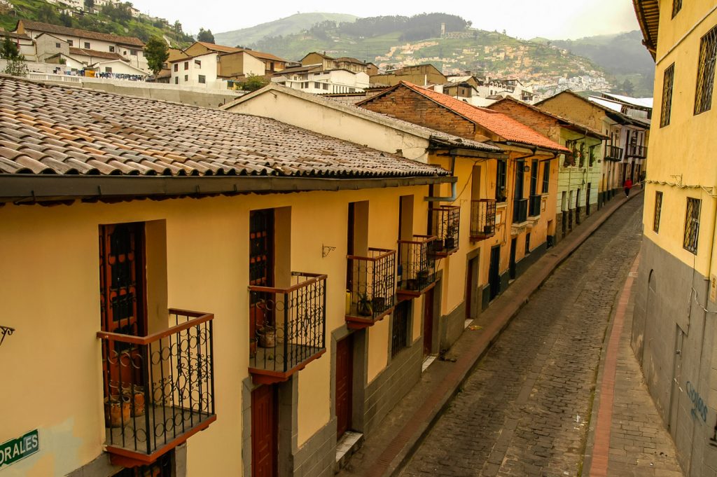
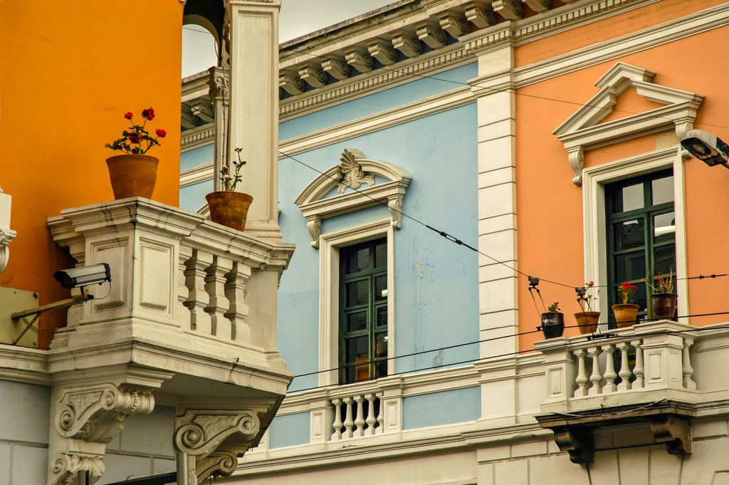
Better rested the next day, I explored Old Quito, the colonial Spanish city, which is well preserved. I spent time at the main square, the Plaza Grande, and explored the cobbled streets lined with houses with classic balconies.
After two nights in Quito, I took a flight to Loja in the south of Ecuador from where I traveled to the small rural town of Vilcabamba, known for its long-living residents and lush green landscapes.
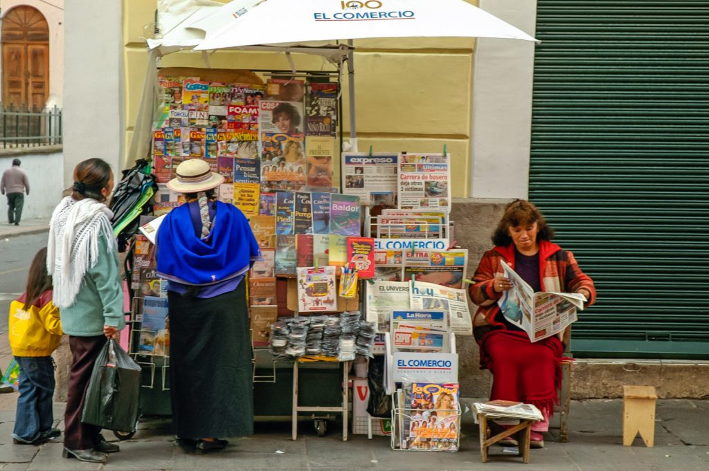
This trio of shoeshine boys was roaming the main plaza in Old Quito looking for work. (Richard McGuire Photo)The colonial street known as La Ronda in Quito’s old town is a narrow cobbled street lined with houses and balconies — one of the oldest in Quito. Efforts are being made to clean up the area and make it safer, but it’s still in a rough area where muggings and bag snatchings do occur. (Richard McGuire Photo)Customers look over a variety of newspapers, magazines and books at a newsstand in Old Quito. Probably every item here is in Spanish, as Quito doesn’t draw the numbers of foreigners that come to some other international capitals. Although many people in Ecuador speak Quichua and other indigenous languages, these are primarily spoken languages, and you don’t see newspapers in Quichua.Many of the houses in Old Quito have balconies, often with potted flowers. (Richard McGuire Photo)